Our guide to winter in Morzine › Morzine piste maps
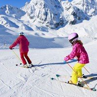
Morzine piste maps: Find your way around the ski area
So, you’re looking for a Morzine piste map?
Well, you’ve found it – you can view and download the three different piste maps you might need in the first section of this article.
But in this guide, we’ve also provided loads of other information about Morzine and Portes Du Soleil pistes maps so you can make the most out of your next ski trip.
By the way... if you’re looking for accommodation in Morzine, be sure to check out our self-catered chalets and apartments.
Contents


Section 1
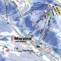
Morzine piste and ski lift maps to view & download
Below are links to the latest versions of all the different Morzine piste maps.
There are three maps to consider because Morzine is one of the towns that make up the huge Portes du Soleil ski area.
So, there is a piste map for:
- The local ski area – Morzine-Les Gets
- The neighbouring Avoriaz ski area
- The whole of the Portes du Soleil ski area
The local area piste maps show more detail than the Portes Du Soleil map which provides more of an overview of the whole ski area.
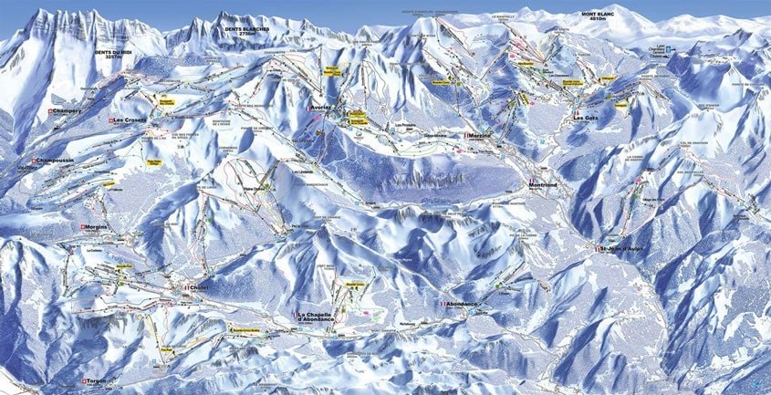
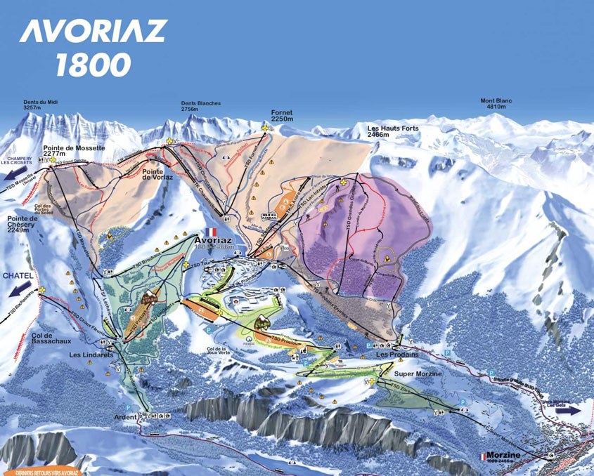
The Portes Du Soleil Piste Map
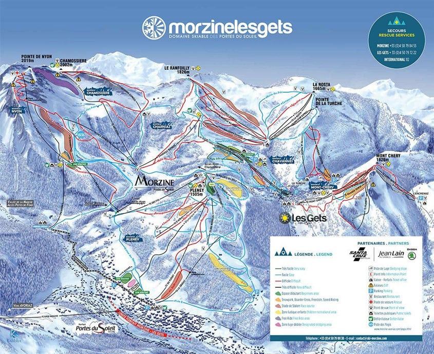
The Morzine Piste Map
The Avoriaz Piste Map
Section 2
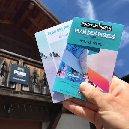
Where to get a piste map to take on the slopes
The best places to pick up piste maps in Morzine are the lift pass offices and the tourist office.
If you’re staying at our self-catered chalets or self-catered apartments you will find piste maps in your accommodation when you arrive.
However, you can also pick up piste maps from the following locations:
Pléney lift pass office
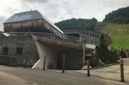
This lift pass office is located at the bottom of the Pléney bubble (the most obvious ski lift in Morzine).
This office will have the Morzine-Les Gets edition of the piste maps which has a map of Morzine-Les Gets on one side and map of the Portes Du Soleil on the other side. You may also be able to pick up Avoriaz editions of the map but they don’t always have them.
Tourist information office

The tourist information office is right in the middle of Morzine, adjacent to the town square. Inside you can find Morzine-Les Gets and Avoriaz editions of the piste map. Both have the local area map on one side and the whole Portes Du Soleil map on the reserve.
Super Morzine lift pass office

This office is located next door to the Super Morzine suspension bridge and is connected to the Super Morzine bubble.
The lift gives you access to Avoriaz and the rest of the Portes Du Soleil and therefore stocks the Avoriaz edition of the piste map – Avoriaz map on one site, Portes du Soleil map on the back. You may also be able to pick up Morzine-Les Gets editions of the map but they don’t always have them.
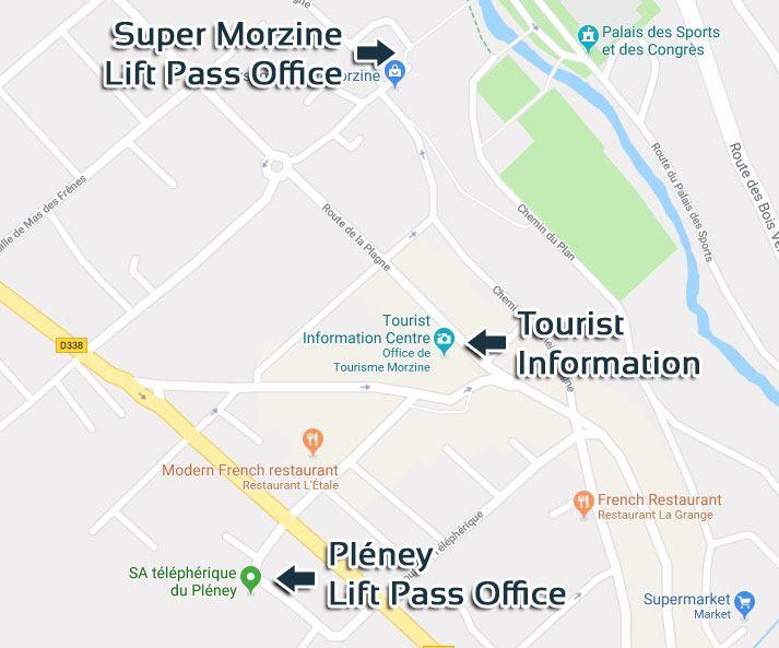
You can also get piste maps from the lift pass offices at Prodains Telecabine, Nyon Telecabine and Ardent Telecabine which are all located further out of Morzine.
Section 4
Understanding the Portes Du Soleil piste map
When you first look at any piste map it can be hard to understand. There are lots of coloured lines going in different directions and icons everywhere!
The Portes Du Soleil piste map can be especially hard to understand because the ski area is so big. The PDS is the biggest international ski area in the world so there is a lot crammed onto one piste map!
To help you quickly get to grips with the map, we’ve put together a quick guide.
Pistes and snow parks
Pistes
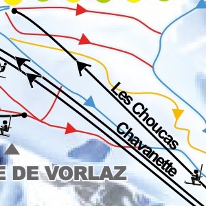
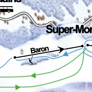
The pistes (or ski runs) are represented on the map by the wiggly lines. These lines have a small arrow on them that tells you the direction you ski down them.
They come in 4 colours which signify the difficulty of the piste:
- Green – very easy piste
- Blues – easy piste
- Reds – difficult piste
- Black – very difficult piste
Additionally, there are Free Zones which are shown in orange. These are ski runs which are off-piste and therefore not groomed and flattened by piste bashers each night. The difficulty of these runs depends on the snow conditions.
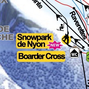
Snow parks
Snow parks are shown by a snowboarder icon and the name of the park in black and yellow. Most snow parks have some easy and some difficult features so no difficulty rating is given on the piste map.
There are over 30 snow parks shown on the Portes Du Soleil piste map and many of the best are in the areas around Morzine.
Ski lifts
Ski lifts are shown on the Morzine piste map and Portes Du Soleil piste map as black straight or curved lines. They have a small arrow with two tails to show you the direction of travel and a small icon to tell you what type of lift they are.
Téléski
A téléski is a drag lift – these tend to cover short distances and be in areas with few skiers.
There aren’t very many of these lifts in the Portes Du Soleil compared to some other ski areas which is great news. Drag lifts are slower and more difficult to ride for beginner skiers and snowboarders.
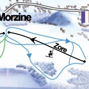
Télésiège
A télésiège is a chair lift – these are either 2, 3, 4, 6 or 8 person lifts and make up the vast majority of the ski lifts around Morzine and throughout the Portes Du Soleil. Chair lifts are fast and easy to ride.

Télécabine
A télécabine is a gondola – these are bigger lifts which require you to take your skis or snowboard off in order to use. They are very fast and carry a lot of people. In the Portes Du Soleil, télécabines are only used for access from towns to the ski area.
For example, Morzine has the Super Morzine, Pleney and Nyon télécabines that lead to both the Avoriaz and Morzine-Les Gets ski areas.
Other Useful Info
Toilets
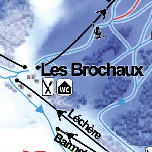
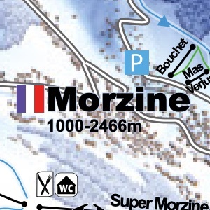
Toilet stops on the mountain are essential, especially if you’re skiing with kids. Toilets are marked on the map with a WC icon.
Meeting Points
To catch some of the most spectacular mountain vistas around Morzine you can visit the recommended viewing points that are marked on the map with a black icon that looks like a sunrise.

View Points
Meeting points can be useful for organising to meet with friends and family on the mountain. They are marked on the piste map with a green and white icon.

Restaurants & Picnic Spots
Stopping for lunch? You’ll either want a restaurant or picnic spot. Restaurants are marked on the piste map with a knife and fork icon, picnic spots with a green picnic bench icon.
Geography
There is more to the Morzine piste maps than just ski runs, lifts and mountain restaurants. They also give you some interesting information about the geography of the region.
The Border
The Portes Du Soleil ski area is in both France and Switzerland and therefore the border is represented on the piste map with a yellow and green dotted line.
Don’t worry, you don’t need your passport to cross the border and ski into a new country! :)
Towns
The 12 towns of the Portes Du Soleil are fairly obvious on the piste map. Each town has a flag next to it so you know if it is in France or Switzerland and the height range of the surrounding ski area.

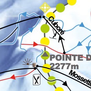
Peaks
Each major mountain peak is marked on the map with its name and its height in meters. This helps you to put a name to the majestic mountain you’re taking in as you sip your mid-morning coffee.
Section 5
Discover three of our favourite areas of the Portes Du Soleil piste map
Pléney
The Pléney télécabine is the main lift from Morzine that takes you into the Morzine-Les Gets ski area.
At the top of the lift are some green nursery slopes as well as a choice of steep and challenging red runs or tree-lined, meandering blue pistes. All these pistes eventually end up at the bottom of the télécabine allowing you to ski lots of different runs all within the same small area. This is a great area of the mountain for families and beginner skiers.
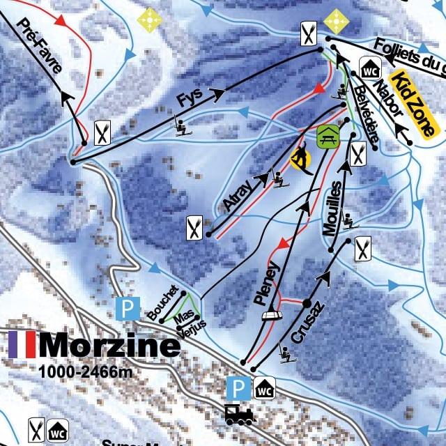
You can find the Pléney by looking slightly to the right of the town of Morzine on the piste map.
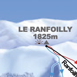
Le Ranfoilly
This bowl is a skier’s dream! It has dozens of rolling red pistes and fun blue runs all served by five chair lifts. These means you can spend a whole day in this area of the mountain without skiing the same run twice.
The views of Mont Blanc from the viewpoint at the top of Le Ranfoilly are spectacular and there are some lovely mountain restaurants to choose from.
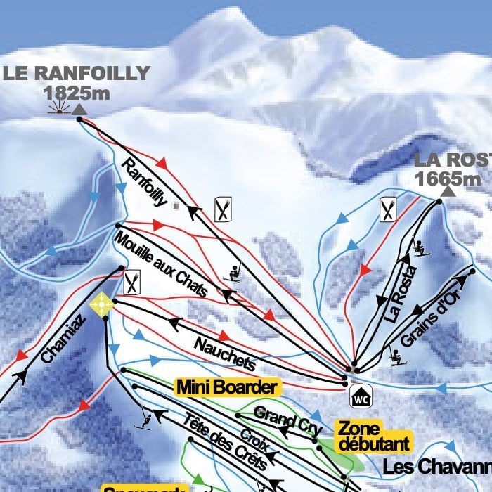
To find Le Ranfoilly on the Portes Du Soleil piste map: Find Morzine and then look up towards the top of the map.
Grandes Combes
The Grandes Combes lift is a chairlift that sits above Avoriaz and takes skiers towards Les Hauts-Forts peak (2466m). The ski area below features steep and fast red & black runs as well as technical, moguled black pistes. It’s a lot of fun if you’ve got the skills – experts only! :)
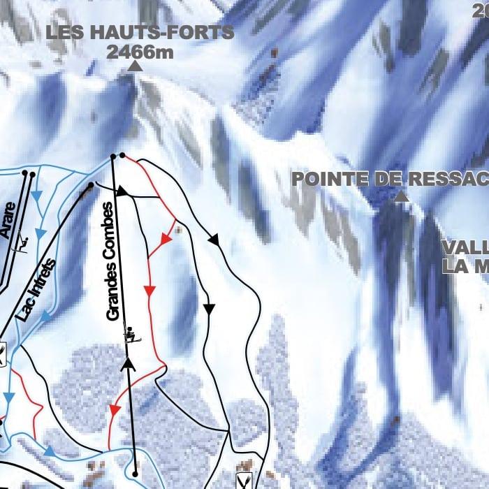
To find Grand Combes on the piste map, find Morzine town and look left and slightly up. Alternatively, it is diagonally up and right from Avoriaz.
Section 6
Cross country skiing piste maps
Morzine and its neighbouring towns of Avoriaz and Les Gets offer dozens of cross country skiing tracks.

The Super Morzine plateau offers six different tracks which can be accessed from Morzine and Avoriaz easily. They vary from easy (green) up to very difficult (black).
In the Morzine-Les Gets ski area there are 12 tracks to choose from. They can be cross-country skied, snow-shoed or, if the snow conditions are right, walked on foot.
We'd love to help
Any questions?
You've reached the end of our Morzine piste map guide!
Did we answer all your questions? If not, we'd be happy to try to help you out further.
Send us a message with your question we'll do our best to answer them for you.
Find out more
Our guide to winter in Morzine
-
 Chapter 1
Morzine, Les Gets & Portes du Soleil ski pass guide
-
 Chapter 2
Ski & snowboard schools in Morzine: A definitive guide
-
 Chapter 3
Morzine piste maps: Find your way around the ski area
-
 Chapter 4
Ski hire in Morzine: The go-to guide
-
 Chapter 5
How to get to Morzine: An experts guide
-
 Chapter 6
A guide to bars in Morzine
-
 Chapter 7
A guide to restaurants in Morzine
-
 Chapter 8
Things to do in Morzine this winter